Import a GPX file

Nantmor trails

Click on a trail to view its statistics, map and profile.
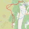
Aberglaslyn towards Cae Coch - thwarted due to too much vegetation

United Kingdom > Wales > Gwynedd > Nantmor

Gwynedd Walking

Distance: 7.9 Km • Elevation gain: 388 m • Maximum elevation: 214 m

Gear up for your next adventure:

📡Satellite Messengers - Emergency messaging when off‑grid
🪵Fire Starters & Tools - Tools to start fire in wet conditions
🏕️Family Camping Sets - Gear packages for family trips
🎁Outdoor Gift Ideas - Great gifts for adventurers
🧥Waterproof Hiking Jackets - Rain jackets for unpredictable weather

As an Amazon Associate, this site earns from qualifying purchases at no extra cost to you.