
Cantal trails
Click on a trail to view its statistics, map and profile.
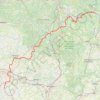
GR®652 Voie de Rocamadour (2021)
France > Auvergne-Rhône-Alpes > Cantal > Laroquebrou > Messac
Randonnée sur le GR®652 Voie de Rocamadour vers Saint-Jacques-de-Compostelle à travers le Cantal, le Lot, le Lot-et-Garonne et le Gers de Laroquebrou à La Romieu. Gîtes d'étapes, Chambres d'hôtes, Maison d'hôtes, Hôtels, Camping, Refuges, Auberges, Commerces.
Distance: 336.6 Km • Elevation gain: 9,067 m • Maximum elevation: 540 m
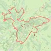
GR 400 Complet ( Murat - Murat )
France > Auvergne-Rhône-Alpes > Cantal > Murat
Distance: 129.4 Km • Elevation gain: 6,231 m • Maximum elevation: 1,823 m