Import a GPX file

Arlingham trails

Click on a trail to view its statistics, map and profile.
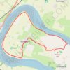
Arlingham Loop Walk

United Kingdom > England > Gloucestershire > Stroud > Arlingham

Distance: 13.6 Km • Elevation gain: 71 m • Maximum elevation: 40 m
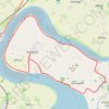
Arlingham Loop

United Kingdom > England > Gloucestershire > Stroud > Arlingham

Distance: 18.1 Km • Elevation gain: 71 m • Maximum elevation: 24 m

Gear up for your next adventure:

🔨Multi-tool Devices - Versatile tools for gear repairs in the field
🥾Lightweight Hiking Shoes - Light, breathable shoes for trail walking
🔧Bicycle Repair Kits - On‑the‑go bike maintenance tools
🌄Sun Protection Gear - Gear to shield from strong sun
🧤Touchscreen Glove Liners - Use your mapping app without freezing your hands

As an Amazon Associate, this site earns from qualifying purchases at no extra cost to you.