
Ferncroft trails
Click on a trail to view its statistics, map and profile.
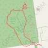
Mount Passaconaway and Mount Whiteface Loop
United States > New Hampshire > Carroll County > Ferncroft
Loop hike from Ferncroft to Mount Passaconaway via Ferncroft Road, Squirrel Bridge Road, Blueberry Ledge Trail, Rollins Trail, Dicey's Mill Trail, View Spur and Walden Trail in the Sandwich Range Wilderness, the Bowl Research Natural Area and the White Mountain National Forest. #Hiking #Loop #Mountain #Forest…
Distance: 18.8 Km • Elevation gain: 1,262 m • Maximum elevation: 1,226 m
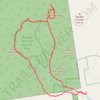
Mount Passaconaway and Mount Whiteface loop via Blueberry Ledge and Dicey's Mill trails
United States > New Hampshire > Carroll County > Ferncroft
Distance: 19.2 Km • Elevation gain: 1,202 m • Maximum elevation: 1,226 m