
Youngberg trails
Click on a trail to view its statistics, map and profile.
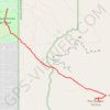
The Flatiron via Siphon Draw Trail in Tonto National Forest
United States > Arizona > Pinal County > Youngberg
The Flatiron via Siphon Draw Trail offers a challenging and rewarding hiking experience within the stunning Superstition Mountains of Tonto National Forest. The route begins with a rocky ascent through exposed terrain, gradually drawing you closer to the dramatic Flatiron peak, which stands out like the bow of…
Distance: 9.2 Km • Elevation gain: 835 m • Maximum elevation: 1,424 m