Import a GPX file

Sheung Che trails

Click on a trail to view its statistics, map and profile.
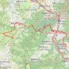
徑口坑 營盤 泰亨坑

China > Hong Kong > Yuen Long District > Sheung Che

Hong Kong Hike

Distance: 16.7 Km • Elevation gain: 1,050 m • Maximum elevation: 487 m

石塘左左 担水徑坑

China > Hong Kong > Yuen Long District > Sheung Che

Hike

Distance: 5.9 Km • Elevation gain: 438 m • Maximum elevation: 474 m
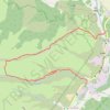
Kai Kung Leng east

China > Hong Kong > Yuen Long District > Sheung Che

Distance: 3.4 Km • Elevation gain: 367 m • Maximum elevation: 396 m

Gear up for your next adventure:

📱Phone Holders for Biking - Secure phone mounts for touring cyclists
🧥Gore-Tex Rain Jackets - Breathable and fully waterproof shells for Irish weather
🌿Irish Flora Guides - Identify plants while exploring the countryside
🥾Women's Waterproof Boots - Gore-Tex protection for trail and mountain walking
🚲Cycling GPS Computers - Topographic mapping for Irish road and mountain biking

As an Amazon Associate, this site earns from qualifying purchases at no extra cost to you.