Import a GPX file

Kittery trails

Click on a trail to view its statistics, map and profile.
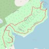
Leland Loop Trail

United States > Maine > York County > Kittery > Kittery Point

Distance: 1.7 Km • Elevation gain: 32 m • Maximum elevation: 18 m
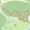
Fort McClary

United States > Maine > York County > Kittery > Kittery Point

Distance: 0.8 Km • Elevation gain: 21 m • Maximum elevation: 19 m

Other places

Gear up for your next adventure:

🌦️Weatherproof Outdoor Gear - Protection from unpredictable weather
🥛Insulated Flasks - Keep drinks hot or cold
🦯Lightweight Trekking Poles - Reduce knee strain on steep Wicklow or Kerry slopes
🗺️Topographic Maps - Detailed maps for hiking, cycling and planning routes
🧴Long-Lasting Sunscreen - Protect against UV rays during long days on the ridges

As an Amazon Associate, this site earns from qualifying purchases at no extra cost to you.