
Redhill trails
Click on a trail to view its statistics, map and profile.
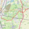
Walk Earlswood to Bletchingley via Green Sand Way, South Nutfield, Steners Hill, Castlehill Farm
United Kingdom > England > Surrey > Reigate and Banstead > Redhill
Distance: 6.8 Km • Elevation gain: 158 m • Maximum elevation: 162 m
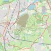
Loop Walk Earlswood, South Nutfield, Nutfield, Nutfield Marsh, Redhill
United Kingdom > England > Surrey > Reigate and Banstead > Redhill
Distance: 14.5 Km • Elevation gain: 159 m • Maximum elevation: 145 m
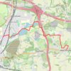
Walk Nutfield Marsh to Bletchingley via Mercer's Lake and Spynes Mere in Surrey Hills National Landscape
United Kingdom > England > Surrey > Reigate and Banstead > Redhill
Distance: 7.4 Km • Elevation gain: 113 m • Maximum elevation: 153 m

Walk Redhill to Hooley via The Moors Nature Reserve, South Mertstham, Tollsworth Manor, Alderstead Heath, Netherne-on-the-Hill
United Kingdom > England > Surrey > Reigate and Banstead > Redhill
Redhill, Hooley, South Mertstham, Alderstead Heath, Netherne-on-the-Hill
Distance: 10.8 Km • Elevation gain: 149 m • Maximum elevation: 197 m
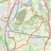
Walk Earlswood to Nutfield March, via South Nutfield
United Kingdom > England > Surrey > Reigate and Banstead > Redhill
Distance: 11.5 Km • Elevation gain: 123 m • Maximum elevation: 145 m
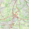
Walk Earlswood, Merstham, Chaldon church, Fartyhing Downs, Coulson
United Kingdom > England > Surrey > Reigate and Banstead > Redhill
Distance: 16.4 Km • Elevation gain: 249 m • Maximum elevation: 197 m

Walk Earlswood to North Merstham, via Nutfirld Marsh, Brewer Street, Tylers Green Godstone, Gravelly Hill, North Downs Way
United Kingdom > England > Surrey > Reigate and Banstead > Redhill
Distance: 17.0 Km • Elevation gain: 235 m • Maximum elevation: 232 m
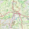
Walk Earlswood to Hooley
United Kingdom > England > Surrey > Reigate and Banstead > Redhill
South Merstham, Earlswood, Alderstead Heath, Netherne, Hooley
Distance: 12.3 Km • Elevation gain: 208 m • Maximum elevation: 197 m