Import a GPX file

Brdo trails

Click on a trail to view its statistics, map and profile.
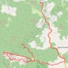
Trenutna trasa: 07 KOL 2018 11:37

Serbia > Central Serbia > Zlatibor Administrative District > Nova Varos Municipality > Brdo

Distance: 23.1 Km • Elevation gain: 784 m • Maximum elevation: 1,612 m

Gear up for your next adventure:

🛠️Tent Repair Kits - Fix tents on the trail
🩴Trail Running Shoes - Fast, grippy shoes for trail runs
🔨Multi-tool Devices - Versatile tools for gear repairs in the field
🪓Camping Hand Axes - For processing wood during forest camping
🧯Campfire Safety Gear - Gear to safely manage fires

As an Amazon Associate, this site earns from qualifying purchases at no extra cost to you.