Import a GPX file

Les Bossons trails

Click on a trail to view its statistics, map and profile.
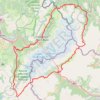
UTMB 2020

France > Auvergne-Rhône-Alpes > Upper Savoy > Chamonix-Mont-Blanc > Les Bossons

Total: 171.3km

Distance: 168.1 Km • Elevation gain: 10,526 m • Maximum elevation: 2,574 m
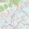
Mont Blanc par les Grands Mulets

France > Auvergne-Rhône-Alpes > Upper Savoy > Chamonix-Mont-Blanc > Les Bossons

Distance: 25.6 Km • Elevation gain: 3,832 m • Maximum elevation: 4,799 m

Gear up for your next adventure:

🧦Hiking Socks - Comfortable socks to prevent blisters
🔋Portable Power Banks - Keep devices charged on long trips
🍖High-Protein Trail Snacks - Lightweight fuel for long distance treks
🧉Camping Coffee Gear - Enjoy coffee outdoors
🔋Solar Power Banks - Keep your GPS and phone charged in the Irish wilderness

As an Amazon Associate, this site earns from qualifying purchases at no extra cost to you.