Import a GPX file

Camden County trails

Click on a trail to view its statistics, map and profile.
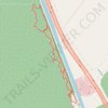
Canal Road and Supple Jack Trail Loop in Dismal Swamp State Park

United States > North Carolina > Camden County

Distance: 3.4 Km • Elevation gain: 12 m • Maximum elevation: 11 m

Gear up for your next adventure:

📚Irish Walking Guides - The best mapped trails in Wicklow, Kerry, and Connemara
📡Satellite Messengers - Emergency communication for remote areas without signal
🛶Waterproof Dry Bags - Keep electronics and clothes dry during wet treks
☕Vacuum Insulated Flasks - Keep tea or coffee hot for 12 hours on the summit
🖼️Vintage Irish Map Prints - Decorative wall art for map lovers and geographers

As an Amazon Associate, this site earns from qualifying purchases at no extra cost to you.