Import a GPX file

Area B (Shelter Bay/Mica Creek) trails

Click on a trail to view its statistics, map and profile.
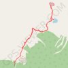
Illecillewaet Campground - Abbott Ridge Trail

Canada > British Columbia > Columbia-Shuswap Regional District > Area B (Shelter Bay/Mica Creek)

Glacier National Park. #Hiking #Glacier

Distance: 12.8 Km • Elevation gain: 1,045 m • Maximum elevation: 2,280 m

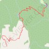
Meadows in the Sky - Eva Lake - Miller Lake

Canada > British Columbia > Columbia-Shuswap Regional District > Area B (Shelter Bay/Mica Creek)

Mount Revelstoke National Park. #Hiking #Revelstoke

Distance: 14.4 Km • Elevation gain: 570 m • Maximum elevation: 1,962 m
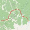
Greely Trail

Canada > British Columbia > Columbia-Shuswap Regional District > Area B (Shelter Bay/Mica Creek)

Distance: 3.9 Km • Elevation gain: 229 m • Maximum elevation: 1,944 m

Gear up for your next adventure:

🎁Outdoor Gift Ideas - Great gifts for adventurers
🚨Emergency Whistles - Safety whistles for hikers
🧺Quick-Dry Hiking Towels - Space-saving towels for wild swimming or camping
🔧Bicycle Repair Kits - On‑the‑go bike maintenance tools
🧤Thermal Outdoor Gloves - Windproof and waterproof gloves for winter hiking

As an Amazon Associate, this site earns from qualifying purchases at no extra cost to you.