Import a GPX file

Area H (Robson Valley/Canoe) trails

Click on a trail to view its statistics, map and profile.

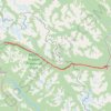
Mount Robson Provincial Park - Jasper

Canada > British Columbia > Regional District of Fraser-Fort George > Area H (Robson Valley/Canoe)

#Bike #Robson #Jasper

Distance: 92.3 Km • Elevation gain: 1,010 m • Maximum elevation: 1,172 m

Gear up for your next adventure:

🔋Portable Power Banks - Keep devices charged on long trips
🧊Winter Boot Traction - Grip for icy paths in the Mourne or Derryveagh mountains
🔦UV Flashlights - Search for minerals or inspect maps at night
💺Camping Hammocks - Relax afloat camp setup
🧥Waterproof Hiking Jackets - Rain jackets for unpredictable weather

As an Amazon Associate, this site earns from qualifying purchases at no extra cost to you.