Import a GPX file

Sulphur Springs trails

Click on a trail to view its statistics, map and profile.
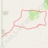
Alamao Canyon Loop in Valles Caldera National Preserve

United States > New Mexico > Sandoval County > Sulphur Springs

Distance: 19.1 Km • Elevation gain: 518 m • Maximum elevation: 2,871 m

Gear up for your next adventure:

🌿Irish Flora Guides - Identify plants while exploring the countryside
📱Rugged Smartphones - Waterproof phones with long battery for offline mapping
🔭Laser Distance Meters - Professional precision measuring for site surveys
🎧Wireless Earbuds - Music on the move
🔗Locking Carabiners - Secure gear to your pack or for light climbing

As an Amazon Associate, this site earns from qualifying purchases at no extra cost to you.