Import a GPX file

Gospel End trails

Click on a trail to view its statistics, map and profile.
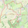
Penn Common and Baggeridge Country Park

United Kingdom > England > Staffordshire > South Staffordshire > Gospel End

Paths around Penn and Baggeridge

Distance: 10.6 Km • Elevation gain: 209 m • Maximum elevation: 180 m
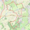
Upper Penn Loop Walk

United Kingdom > England > Staffordshire > South Staffordshire > Gospel End

Distance: 10.5 Km • Elevation gain: 197 m • Maximum elevation: 180 m

Gear up for your next adventure:

📚Irish Walking Guides - The best mapped trails in Wicklow, Kerry, and Connemara
🧺Waterproof Picnic Blankets - Dry seating for breaks on damp grass
📚Travel Books Ireland - Best travel books for Irish exploration
📡Satellite Messengers - Emergency communication for remote areas without signal
🧿Weather Radios - Track weather in remote places

As an Amazon Associate, this site earns from qualifying purchases at no extra cost to you.