Import a GPX file

La Tour-de-Trême trails

Click on a trail to view its statistics, map and profile.
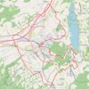
Bulle and its surrounding castles – Shortened alternative

Switzerland > Fribourg > Gruyère District > Bulle > La Tour-de-Trême

Would you like to discover the Châteaux of Bulle and Gruyères by bike ?

Distance: 32.4 Km • Elevation gain: 477 m • Maximum elevation: 874 m

Gear up for your next adventure:

🚲Cycling GPS Computers - Topographic mapping for Irish road and mountain biking
🗾Ireland Map Books - Top map books for exploring Ireland
🌂Windproof Trekking Umbrellas - Protection during vertical Irish rain
💡Hiking Headlamps - Hands‑free lights for night hikes
🚨Emergency Whistles - Safety whistles for hikers

As an Amazon Associate, this site earns from qualifying purchases at no extra cost to you.