Import a GPX file

Caingin trails

Click on a trail to view its statistics, map and profile.
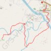
Maragondon - Bonifacio Shrine and Eco-Tourism Park

Philippines > Cavite > Maragondon > Caingin

#Hiking

Distance: 11.1 Km • Elevation gain: 113 m • Maximum elevation: 37 m
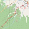
Maragondon - Mount Kalanggaman

Philippines > Cavite > Maragondon > Caingin

#Hiking

Distance: 28.3 Km • Elevation gain: 790 m • Maximum elevation: 559 m

Gear up for your next adventure:

👖Zip-off Hiking Pants - Adapt to changing Irish temperatures quickly
🥾Men's Waterproof Boots - Sturdy footwear for wet and boggy Irish terrain
📦Outdoor Storage Bags - Keep gear organized and dry
🛶Waterproof Dry Bags - Keep electronics and clothes dry during wet treks
📈Fitness Trackers - Monitor activity and hike metrics

As an Amazon Associate, this site earns from qualifying purchases at no extra cost to you.