Import a GPX file

Carbondale trails

Click on a trail to view its statistics, map and profile.

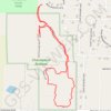
Chautauqua Bottoms Loop (Carbondale)

United States > Illinois > Jackson County > Carbondale

Loop hike in Chautauqua Bottoms via Nature Trail. #Hiking #Loop #Nature #Forest

Distance: 2.8 Km • Elevation gain: 16 m • Maximum elevation: 127 m

Gear up for your next adventure:

🧯Camp Safety Kits - All‑in‑one safety gear
🧤Thermal Outdoor Gloves - Windproof and waterproof gloves for winter hiking
🧦Hiking Socks - Comfortable socks to prevent blisters
🧭Sighting Compasses - Professional grade mirror compass for precise orientation
🩻Outdoor Health Essentials - Necessary health items for hikes

As an Amazon Associate, this site earns from qualifying purchases at no extra cost to you.