Import a GPX file

Tubici trails

Click on a trail to view its statistics, map and profile.
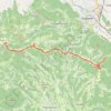
Trenutna trasa: 12 SIJ 2020 08:22

Serbia > Central Serbia > Zlatibor Administrative District > Kosjeric Municipality > Tubici

Distance: 18.6 Km • Elevation gain: 637 m • Maximum elevation: 1,013 m

Gear up for your next adventure:

🎒Waterproof Backpacks - Protect your gear from rain on Irish hikes
🥾Lightweight Hiking Shoes - Light, breathable shoes for trail walking
🦯Lightweight Trekking Poles - Reduce knee strain on steep Wicklow or Kerry slopes
🔋Lithium Batteries - Best performance for digital devices in cold weather
🥾Hiking Boots - Top hiking boots for Irish trails and rugged terrain

As an Amazon Associate, this site earns from qualifying purchases at no extra cost to you.