Import a GPX file

Totnes trails

Click on a trail to view its statistics, map and profile.
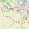
Totnes hike

United Kingdom > England > Devon > South Hams > Totnes > Dartington

Distance: 8.4 Km • Elevation gain: 243 m • Maximum elevation: 149 m

From Knowles Hill to Follaton

United Kingdom > England > Devon > South Hams > Totnes

Ebike ride

Distance: 55.7 Km • Elevation gain: 1,011 m • Maximum elevation: 123 m

Other places

Gear up for your next adventure:

⌚Solar Multisport Watches - Advanced mapping and GPS tracking for endurance hikers
🪶Down Jackets - Warm jackets for cold outdoor trips
🧯Portable Extinguishers - Safety tools for campfires
🛡️Protective Bike Gear - Helmets & pads for safe rides
🧥Gore-Tex Rain Jackets - Breathable and fully waterproof shells for Irish weather

As an Amazon Associate, this site earns from qualifying purchases at no extra cost to you.