Import a GPX file

Unstone Green trails

Click on a trail to view its statistics, map and profile.
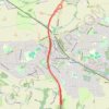
RE SK350770 3

United Kingdom > England > Derbyshire > North East Derbyshire > Dronfield > Unstone Green

Distance: 9.6 Km • Elevation gain: 95 m • Maximum elevation: 195 m
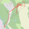
RE SK370780 2

United Kingdom > England > Derbyshire > North East Derbyshire > Dronfield > Unstone Green

Distance: 2.5 Km • Elevation gain: 40 m • Maximum elevation: 132 m

Gear up for your next adventure:

🧭Route Planning Books - Plan the best hiking routes
🔧Bicycle Repair Kits - On‑the‑go bike maintenance tools
🪑Compact Camp Chairs - Comfortable seating after a long day of mapping
🧉Camping Coffee Gear - Enjoy coffee outdoors
🖼️Vintage Irish Map Prints - Decorative wall art for map lovers and geographers

As an Amazon Associate, this site earns from qualifying purchases at no extra cost to you.