Import a GPX file

Kawartha Lakes trails

Click on a trail to view its statistics, map and profile.

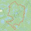
Queen Elizabeth II Wildlands Provincial Park

Canada > Ontario > Kawartha Lakes

#Hiking #Loop #Elizabeth

Distance: 12.6 Km • Elevation gain: 95 m • Maximum elevation: 263 m

Gear up for your next adventure:

📸Travel Camera Tripods - Steady shots for landscape and long-exposure photos
🖼️Vintage Irish Map Prints - Decorative wall art for map lovers and geographers
🧗Rock Climbing Gear - Essentials for the cliffs of Moher or Gap of Dunloe
🌍Travel Adapters - Adapters for international travel
🩹Compact First Aid Kits - Treat blisters and minor injuries on the trail

As an Amazon Associate, this site earns from qualifying purchases at no extra cost to you.