
Yell County trails
Click on a trail to view its statistics, map and profile.
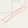
Danville Mountain Trail (Upper Loop, Extended) in Ouachita National Forest
United States > Arkansas > Yell County > Danville
Distance: 4.3 Km • Elevation gain: 146 m • Maximum elevation: 326 m
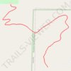
Danville Mountain Trail (Lower Section) in Ouachita National Forest
United States > Arkansas > Yell County > Danville
Distance: 2.1 Km • Elevation gain: 118 m • Maximum elevation: 225 m

Mount Nebo State Park Trails
United States > Arkansas > Yell County > Mount Nebo
Distance: 42.3 Km • Elevation gain: 1,354 m • Maximum elevation: 544 m