Import a GPX file

Brickendon trails

Click on a trail to view its statistics, map and profile.
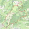
Circuit from Broxbourne Woods

United Kingdom > England > Hertfordshire > East Hertfordshire > Brickendon

Broxbourne woods

Distance: 13.6 Km • Elevation gain: 169 m • Maximum elevation: 117 m

Gear up for your next adventure:

💳Travel Cards for Ireland - Convenient payment abroad
🧴Anti-Chafe Sticks - Prevent friction during long distance walking
📍Handheld GPS Devices - Accurate GPS units for mapping and navigation
🔨Multi-tool Devices - Versatile tools for gear repairs in the field
☕Vacuum Insulated Flasks - Keep tea or coffee hot for 12 hours on the summit

As an Amazon Associate, this site earns from qualifying purchases at no extra cost to you.