Import a GPX file

West Magnolia Campground trails

Click on a trail to view its statistics, map and profile.
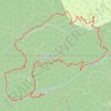
School bus mountain biking route with Mines

United States > Colorado > Boulder County > West Magnolia Campground

Distance: 10.2 Km • Elevation gain: 341 m • Maximum elevation: 2,888 m

Gear up for your next adventure:

🧤Thermal Outdoor Gloves - Windproof and waterproof gloves for winter hiking
🔭Portable Monoculars - One-handed optics for quick route checking
🥘Camping Cookware Sets - Cookware sets for backpacking meals
🗺️Irish Road Atlases - Comprehensive physical maps for road trips and navigation
🔋Rechargeable Batteries - Eco-friendly power for headlamps and GPS units

As an Amazon Associate, this site earns from qualifying purchases at no extra cost to you.