
Рајац trails
Click on a trail to view its statistics, map and profile.
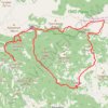
Rajac - Šiljak - Suvobor - Rajac
Serbia > Central Serbia > Moravica Administrative District > Gornji Milanovac Municipality > Polom > Рајац
Distance: 20.4 Km • Elevation gain: 667 m • Maximum elevation: 848 m
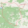
Ex. 'Lovačke priče' - Ravna reka - Dobra voda - Rajac vrh
Serbia > Central Serbia > Moravica Administrative District > Gornji Milanovac Municipality > Polom > Рајац
Distance: 16.3 Km • Elevation gain: 570 m • Maximum elevation: 843 m