Import a GPX file

Maine-et-Loire trails

Click on a trail to view its statistics, map and profile.
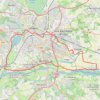
Trace-gpx-boucle-angevine-de-la-loire-a-velo-2561186 4

France > Pays de la Loire > Maine-et-Loire > Angers

Distance: 39.8 Km • Elevation gain: 138 m • Maximum elevation: 54 m

Other places

Gear up for your next adventure:

🗺️Irish Road Atlases - Comprehensive physical maps for road trips and navigation
🚨Emergency Whistles - Safety whistles for hikers
💧Portable Water Filters - Safe drinking water from streams and lakes
🧯Camp Safety Kits - All‑in‑one safety gear
🥾Women's Waterproof Boots - Gore-Tex protection for trail and mountain walking

As an Amazon Associate, this site earns from qualifying purchases at no extra cost to you.