Import a GPX file

Epirus and Western Macedonia trails

Click on a trail to view its statistics, map and profile.
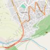
7 Μαρ 2024 11:55:49 π.μ.

Greece > Epirus and Western Macedonia > Ioannina Regional Unit > Κόνιτσα

Distance: 4.2 Km • Elevation gain: 37 m • Maximum elevation: 603 m

Other places

Gear up for your next adventure:

🍖High-Protein Trail Snacks - Lightweight fuel for long distance treks
🔋Solar Power Banks - Keep your GPS and phone charged in the Irish wilderness
🚰Hydration Packs - Hands‑free water storage for hikers
🎒Fully Waterproof Rucksacks - Submersible protection for river crossings
💧Portable Water Filters - Safe drinking water from streams and lakes

As an Amazon Associate, this site earns from qualifying purchases at no extra cost to you.