
Bruges trails
Click on a trail to view its statistics, map and profile.
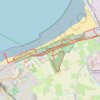
Natuur tussen Zeebrugge en Blankenberge
Belgium > West Flanders > Brugge > Bruges > Zeebrugge
<p>Op zo’n 100 meter van de zee ligt natuurgebied De Fonteintjes, een langgerekt en rustgevend duinengebied. Deze wandeling voert je er even heen, en daarna langs de pier van Blankenberge. Een perfect recept voor een zonnige dag.</p> <p>-------------------------------------------<br/> Tekst en foto Mark…
Distance: 10.8 Km • Elevation gain: 62 m • Maximum elevation: 14 m
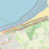
Wandeling naar Natuurgebied De Fonteintjes 6.6km
Belgium > West Flanders > Brugge > Bruges > Zeebrugge
Distance: 6.5 Km • Elevation gain: 31 m • Maximum elevation: 10 m