
Peachtree City trails
Click on a trail to view its statistics, map and profile.
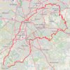
Atlanta, Lilburn, Yellow River Park, Panola, Jonesboro
United States > Georgia > Fayette County > Peachtree City > Stop
Distance: 335.0 Km • Elevation gain: 4,058 m • Maximum elevation: 338 m
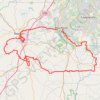
Newnan, Moreland, Brooks gravel
United States > Georgia > Fayette County > Peachtree City
Distance: 181.4 Km • Elevation gain: 1,737 m • Maximum elevation: 310 m
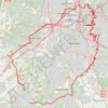
Morrow, Forest Park, Atlanta, Fairburn
United States > Georgia > Fayette County > Peachtree City
Distance: 186.0 Km • Elevation gain: 1,824 m • Maximum elevation: 325 m