
West Lothian trails
Click on a trail to view its statistics, map and profile.
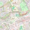
River Almond riverside paths
United Kingdom > Scotland > West Lothian > Livingston
Distance: 4.8 Km • Elevation gain: 34 m • Maximum elevation: 113 m
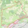
Beecraigs Hill Riccarton Hill Cairn
United Kingdom > Scotland > West Lothian > Livingston
Distance: 25.6 Km • Elevation gain: 376 m • Maximum elevation: 293 m

Pates Hill and neighbouring wind farm
United Kingdom > Scotland > West Lothian
Distance: 5.5 Km • Elevation gain: 56 m • Maximum elevation: 361 m