
Portreath trails
Click on a trail to view its statistics, map and profile.
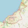
Portreath Oorthtowan Loop
United Kingdom > England > Cornwall > Portreath
Portreath, Oorthtowan
Distance: 22.6 Km • Elevation gain: 852 m • Maximum elevation: 103 m
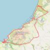
Portreath to Porthtowan
United Kingdom > England > Cornwall > Portreath
Distance: 23.7 Km • Elevation gain: 942 m • Maximum elevation: 104 m
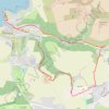
Portreath Walk
United Kingdom > England > Cornwall > Portreath
Distance: 6.6 Km • Elevation gain: 176 m • Maximum elevation: 85 m