Import a GPX file

Yim Tin Tsai trails

Click on a trail to view its statistics, map and profile.
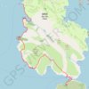
神仙井坑 狗仔坑 較水寮坑

China > Hong Kong > Sai Kung District > Yim Tin Tsai

Distance: 6.9 Km • Elevation gain: 265 m • Maximum elevation: 131 m
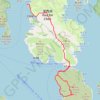
大往灣坑 泥鯭埔坑

China > Hong Kong > Sai Kung District > Yim Tin Tsai

Hong Kong Hike

Distance: 8.7 Km • Elevation gain: 376 m • Maximum elevation: 147 m

Gear up for your next adventure:

🥾Lightweight Hiking Shoes - Light, breathable shoes for trail walking
🌲Bushcraft Skills Books - Learn navigation, fire-making, and shelter building
🔋Portable Power Banks - Keep devices charged on long trips
🌂Windproof Trekking Umbrellas - Protection during vertical Irish rain
🕶️Polarized Sunglasses - Reduce glare from lakes and sea cliffs

As an Amazon Associate, this site earns from qualifying purchases at no extra cost to you.