Import a GPX file

Shipston-on-Stour trails

Click on a trail to view its statistics, map and profile.
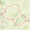
Shipston 🔁 Brailes

United Kingdom > England > Warwickshire > Stratford-on-Avon > Shipston-on-Stour

Distance: 19.2 Km • Elevation gain: 258 m • Maximum elevation: 182 m

Gear up for your next adventure:

🪑Compact Camp Chairs - Comfortable seating after a long day of mapping
🕶️Polarized Sunglasses - Reduce glare from lakes and sea cliffs
🔒Outdoor Gear Locks - Secure your equipment
🔌Travel Adapters - Essential for visitors to charge gear in Ireland
🧿Weather Radios - Track weather in remote places

As an Amazon Associate, this site earns from qualifying purchases at no extra cost to you.