
Kriva Feja trails
Click on a trail to view its statistics, map and profile.
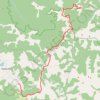
Besna Kobila (1923m)-Veliki Streser (1878m)-Topli Do hiking,...
Serbia > Central Serbia > Pcinja Administrative District > Vranjska Banja > Kriva Feja > Barje
Distance: 27.1 Km • Elevation gain: 1,067 m • Maximum elevation: 1,907 m
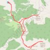
Besna kobila: od pl.doma na vrhove Musulj Čukar, Besna kobil...
Serbia > Central Serbia > Pcinja Administrative District > Vranjska Banja > Kriva Feja > Barje
Distance: 18.9 Km • Elevation gain: 939 m • Maximum elevation: 1,917 m
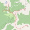
Trenutna trasa: 29 KOL 2015 09:15 001
Serbia > Central Serbia > Pcinja Administrative District > Vranjska Banja > Kriva Feja > Barje
Distance: 20.2 Km • Elevation gain: 943 m • Maximum elevation: 1,909 m