Import a GPX file

Wendover trails

Click on a trail to view its statistics, map and profile.
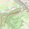
Coombe Hill from Wendover

United Kingdom > England > Buckinghamshire > Wendover

Distance: 6.7 Km • Elevation gain: 146 m • Maximum elevation: 261 m

Coombe Hill Loop Trail

United Kingdom > England > Buckinghamshire > Wendover

Distance: 9.2 Km • Elevation gain: 188 m • Maximum elevation: 257 m

Gear up for your next adventure:

🧥Waterproof Hiking Jackets - Rain jackets for unpredictable weather
🖼️Vintage Irish Map Prints - Decorative wall art for map lovers and geographers
🛶Kayaking & Water Sports Gear - Equip for water adventures
📸Travel Camera Tripods - Steady shots for landscape and long-exposure photos
📚Irish Walking Guides - The best mapped trails in Wicklow, Kerry, and Connemara

As an Amazon Associate, this site earns from qualifying purchases at no extra cost to you.