Import a GPX file

Bohortha trails

Click on a trail to view its statistics, map and profile.

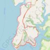
St. Mawes Loop

United Kingdom > England > Cornwall > Bohortha

Loop hike from St. Mawes via St Mawes Castle, St Just-In-Roseland, Halwartha and Porth Creek in the Cornwall National Landscape. #Hiking #Loop #Nature #Countryside #Sea #Channel #Coast #River

Distance: 12.4 Km • Elevation gain: 235 m • Maximum elevation: 82 m

Gear up for your next adventure:

🚲Cycling GPS Computers - Topographic mapping for Irish road and mountain biking
📻Emergency Crank Radios - Stay informed in remote areas without power
🛌3-Season Sleeping Bags - Comfortable insulation for Irish spring and autumn nights
🧺Quick-Dry Hiking Towels - Space-saving towels for wild swimming or camping
🎒Surveyor High-Vis Vests - Multi-pocket safety vests for field professionals

As an Amazon Associate, this site earns from qualifying purchases at no extra cost to you.