Import a GPX file

Murthly trails

Click on a trail to view its statistics, map and profile.
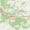
Murthly to Kinclaven Wood, Perthshire

United Kingdom > Scotland > Perth and Kinross > Murthly > Gellyburn

Loop run / hike via Gellyburn, Murthly, River Tay, Ballathie Bluebell Woods and Old England Loch. #Running #Hiking #Loop #Nature #Forest #River #Countryside #Lake

Distance: 14.5 Km • Elevation gain: 136 m • Maximum elevation: 82 m

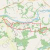
Mountain Bike loop ride around Murthly, Perthshire Scotland

United Kingdom > Scotland > Perth and Kinross > Murthly > Gellyburn

UK, Perthshire, Dunkeld, Murthly

Distance: 18.0 Km • Elevation gain: 298 m • Maximum elevation: 178 m
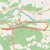
Gravel ride around Murthly Castle

United Kingdom > Scotland > Perth and Kinross > Murthly > Gellyburn

Distance: 10.0 Km • Elevation gain: 127 m • Maximum elevation: 123 m

Other places

Gear up for your next adventure:

🪶Down Jackets - Warm jackets for cold outdoor trips
⛺Emergency Bivvy Bags - Life-saving heat-reflective shelter for emergencies
🖊️All-Weather Pens - Pressurized ink cartridges that write upside down and in wet
🥾Hiking Boots - Top hiking boots for Irish trails and rugged terrain
⛺Ultralight Hiking Tents - Compact shelters for multi-day wild camping in Ireland

As an Amazon Associate, this site earns from qualifying purchases at no extra cost to you.