Import a GPX file

Arapahoe County trails

Click on a trail to view its statistics, map and profile.

Waterton Canyon

United States > Colorado > Arapahoe County > Littleton

Distance: 57.4 Km • Elevation gain: 748 m • Maximum elevation: 1,834 m
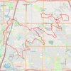
Littleton Gravel/Unpaved Cycling

United States > Colorado > Arapahoe County > Littleton

Distance: 57.2 Km • Elevation gain: 313 m • Maximum elevation: 1,710 m

Other places

Gear up for your next adventure:

⌚Solar Multisport Watches - Advanced mapping and GPS tracking for endurance hikers
🥣Outdoor Food & Meals - Dehydrated meals for backpacking
🥾Hiking Boots - Top hiking boots for Irish trails and rugged terrain
🌂Windproof Trekking Umbrellas - Protection during vertical Irish rain
⛺Emergency Bivvy Bags - Life-saving heat-reflective shelter for emergencies

As an Amazon Associate, this site earns from qualifying purchases at no extra cost to you.