Import a GPX file

Dragodol trails

Click on a trail to view its statistics, map and profile.
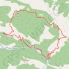
Tisovik - reka Ljubovidja

Serbia > Central Serbia > Kolubara Administrative District > Osecina Municipality > Dragodol

Distance: 11.6 Km • Elevation gain: 698 m • Maximum elevation: 946 m

Gear up for your next adventure:

💺Camping Hammocks - Relax afloat camp setup
📱Phone Holders for Biking - Secure phone mounts for touring cyclists
💨Windbreakers - Protection from strong winds
🥾Waterproof Hiking Boots - Best waterproof boots for wet Irish weather
🎒Hiking Backpacks - Durable backpacks for day hikes and multi‑day treks

As an Amazon Associate, this site earns from qualifying purchases at no extra cost to you.