Import a GPX file

Meurthe-et-Moselle trails

Click on a trail to view its statistics, map and profile.
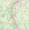
Marche Nancy - Metz

France > Grand Est > Meurthe-et-Moselle > Maxéville

Distance: 64.6 Km • Elevation gain: 810 m • Maximum elevation: 356 m
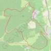
Mont-le-Vignoble

France > Grand Est > Meurthe-et-Moselle > Mont-le-Vignoble

Distance: 14.8 Km • Elevation gain: 381 m • Maximum elevation: 420 m

Other places

 •

Gear up for your next adventure:

📦Outdoor Storage Bags - Keep gear organized and dry
💡Hiking Headlamps - Hands‑free lights for night hikes
🔌Fast Car Chargers - Recharge GPS and phones between trailheads
🗺️Topographic Maps - Detailed maps for hiking, cycling and planning routes
🧣Multi-functional Neckwear - Protect against wind and sun with versatile Buffs

As an Amazon Associate, this site earns from qualifying purchases at no extra cost to you.