Import a GPX file

Letterfrack trails

Click on a trail to view its statistics, map and profile.
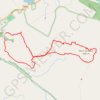
Diamond Hill

Ireland > County Galway > Letterfrack

Connemara National Park. #Hiking #Loop #DiamondHill #Connemara

Distance: 7.0 Km • Elevation gain: 396 m • Maximum elevation: 435 m

Gear up for your next adventure:

🔗Locking Carabiners - Secure gear to your pack or for light climbing
📱Rugged Smartphones - Waterproof phones with long battery for offline mapping
🌦️Weatherproof Outdoor Gear - Protection from unpredictable weather
🔥Compact Camping Stoves - Fast-boil stoves for trail-side meals and coffee
🥾Women's Waterproof Boots - Gore-Tex protection for trail and mountain walking

As an Amazon Associate, this site earns from qualifying purchases at no extra cost to you.