Import a GPX file

Nye County trails

Click on a trail to view its statistics, map and profile.

Ash Meadows National Wildlife Refuge: Longstreet Peak - Deacon Peak Loop Hike

United States > Nevada > Nye County

Distance: 10.8 Km • Elevation gain: 383 m • Maximum elevation: 956 m
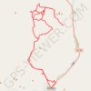
Beatty

United States > Nevada > Nye County > Beatty

Distance: 64.2 Km • Elevation gain: 1,555 m • Maximum elevation: 1,357 m

Other places

Gear up for your next adventure:

📚Irish Walking Guides - The best mapped trails in Wicklow, Kerry, and Connemara
🧢Hiking Hats & Caps - Protective headwear for sun and rain
🛌Cold Weather Sleeping Bags - Warm sleeping bags for colder hikes
🥄Titanium Sporks - Indestructible and ultralight eating utensil
🧴Long-Lasting Sunscreen - Protect against UV rays during long days on the ridges

As an Amazon Associate, this site earns from qualifying purchases at no extra cost to you.