
Vielha e Mijaran trails
Click on a trail to view its statistics, map and profile.
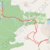
Tossal d'Escobidieso - Pic de Baserca - Punta Senyalada
Spain > Catalonia > Val d'Aran > Vielha e Mijaran
Distance: 16.9 Km • Elevation gain: 1,763 m • Maximum elevation: 2,934 m
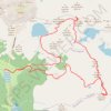
Circular vall de Conangles
Spain > Catalonia > Val d'Aran > Vielha e Mijaran
Espitau de Vielha - coll de Conangles - tuc des Estanhets - coll de Conangles - tuc de Conangles - tuc de Tòrt - port de Rius - tuc de Sarrahèra - lac Redon - Espitau de Vielha
Distance: 18.3 Km • Elevation gain: 1,689 m • Maximum elevation: 2,862 m