Import a GPX file

Pujols trails

Click on a trail to view its statistics, map and profile.
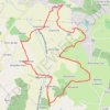
2010PujolsValleeduMail

France > Nouvelle-Aquitaine > Lot-et-Garonne > Pujols > Sous Chays

Distance: 10.3 Km • Elevation gain: 398 m • Maximum elevation: 199 m
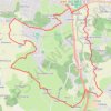
2010PujolsDoumillac

France > Nouvelle-Aquitaine > Lot-et-Garonne > Pujols > Sous Chays

Distance: 13.1 Km • Elevation gain: 403 m • Maximum elevation: 197 m

Other places

Gear up for your next adventure:

🧊Hydration Reservoirs - Easy drinking on the move with 2L or 3L bladders
⛺Camping Tents - Top tents for Irish weather and conditions
🌲Bushcraft Skills Books - Learn navigation, fire-making, and shelter building
🔋Solar Power Banks - Keep your GPS and phone charged in the Irish wilderness
📍Trail Markers & GPS - Tools to track and mark trails

As an Amazon Associate, this site earns from qualifying purchases at no extra cost to you.