Import a GPX file

Kenninghall trails

Click on a trail to view its statistics, map and profile.
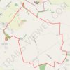
Loop walk from Kenninghall

United Kingdom > England > Norfolk > Breckland District > Kenninghall > Edge Green

Distance: 12.6 Km • Elevation gain: 59 m • Maximum elevation: 56 m

Other places

Gear up for your next adventure:

🥾Waterproof Hiking Boots - Best waterproof boots for wet Irish weather
🌲Survival Gear - Equipment for outdoor survival situations
🌲Bushcraft Skills Books - Learn navigation, fire-making, and shelter building
🔋Lithium Batteries - Best performance for digital devices in cold weather
🔦UV Flashlights - Search for minerals or inspect maps at night

As an Amazon Associate, this site earns from qualifying purchases at no extra cost to you.