Import a GPX file

Chap Wai Kon Village trails

Click on a trail to view its statistics, map and profile.
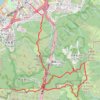
長繩脊

China > Hong Kong > Sha Tin District > Chap Wai Kon Village

Distance: 10.5 Km • Elevation gain: 794 m • Maximum elevation: 545 m
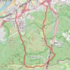
Dome hill

China > Hong Kong > Sha Tin District > Chap Wai Kon Village > Ngau Pei Sha New Village

Hong Kong Trail Run

Distance: 7.5 Km • Elevation gain: 465 m • Maximum elevation: 422 m

Other places

Gear up for your next adventure:

🧉Camping Coffee Gear - Enjoy coffee outdoors
💡Hiking Headlamps - Hands‑free lights for night hikes
🔦LED Flashlights - Bright, durable flashlights for outdoor use
📍Handheld GPS Devices - Accurate GPS units for mapping and navigation
🛶Inflatable Touring Kayaks - Explore Irish loughs and coastal topography

As an Amazon Associate, this site earns from qualifying purchases at no extra cost to you.