Import a GPX file

San Uk Tsuen trails

Click on a trail to view its statistics, map and profile.
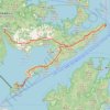
鬼手岩行山路線:環湖出咀摸鬼手

China > Hong Kong > North District > Wu Kau Tang > San Uk Tsuen

烏蛟騰-船灣淡水湖郊遊徑-鹿湖峒-跌死狗-分叉路口-鳳凰笏頂-鬼手岩-分叉路口-小滘坳-鵝髻頂-副壩-主壩-大美督

Distance: 27.3 Km • Elevation gain: 1,188 m • Maximum elevation: 290 m
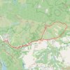
吊燈籠

China > Hong Kong > North District > Wu Kau Tang > San Uk Tsuen

Distance: 8.2 Km • Elevation gain: 420 m • Maximum elevation: 376 m

Gear up for your next adventure:

📍Trail Markers & GPS - Tools to track and mark trails
📍Handheld GPS Devices - Accurate GPS units for mapping and navigation
🔦Everyday Carry Torches - Reliable backup light for your hiking pack
📡Satellite Messengers - Emergency communication for remote areas without signal
🧤Touchscreen Glove Liners - Use your mapping app without freezing your hands

As an Amazon Associate, this site earns from qualifying purchases at no extra cost to you.