Import a GPX file

Côtes-d'Armor trails

Click on a trail to view its statistics, map and profile.

Trail de Guerlédan

France > Brittany > Côtes-d'Armor > Bon Repos sur Blavet > Bellevue

Distance: 23.1 Km • Elevation gain: 770 m • Maximum elevation: 271 m
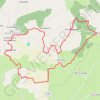
LGT : Bulat-Paetivien : le Circuit des Brigants

France > Brittany > Côtes-d'Armor > Bulat-Pestivien > Le Corong

Distance: 10.7 Km • Elevation gain: 173 m • Maximum elevation: 290 m

Other places

 •

Gear up for your next adventure:

🧴Hiking Sunscreen - Sun protection for long exposure
🚶‍♂️Trekking Poles - Supportive poles for stability on varied terrain
🚲Cycling GPS Computers - Topographic mapping for Irish road and mountain biking
🧭Hiking Compasses - Reliable compasses for navigation off‑trail
📱Phone Holders for Biking - Secure phone mounts for touring cyclists

As an Amazon Associate, this site earns from qualifying purchases at no extra cost to you.