Import a GPX file

Mount Baldy trails

Click on a trail to view its statistics, map and profile.
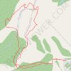
Baldy Mountain

Canada > British Columbia > Regional District of Kootenay Boundary > Area E (Beaverdell/West Boundary) > Mount Baldy

Distance: 8.8 Km • Elevation gain: 522 m • Maximum elevation: 2,303 m

Gear up for your next adventure:

🔥Camping Stoves - Portable camping stoves for outdoor cooking
🧥Gore-Tex Rain Jackets - Breathable and fully waterproof shells for Irish weather
🕶️Polarized Sunglasses - Reduce glare from lakes and sea cliffs
🪶Ultralight Tents - Lightweight shelters for hikers
🦯Lightweight Trekking Poles - Reduce knee strain on steep Wicklow or Kerry slopes

As an Amazon Associate, this site earns from qualifying purchases at no extra cost to you.